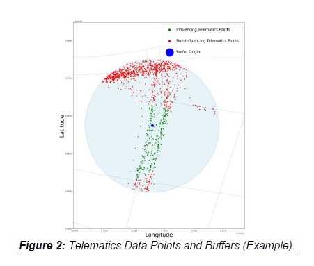
Spatial data play a key role in road safety analysis, with OpenStreetMap (OSM) offering valuable geospatial insights. This study presents an improved method for aggregating telematics data from a smartphone app into OSM entities, such as nodes and edges, to enhance road safety spatial analysis. The dataset used in the study consists of several trips where each instance is characterized by geospatial coordinate corresponding to driver locations, along with features related to driver dynamics. Telematics data was aggregated to edges using the nearest edge approach and to nodes with a buffer method, introducing inconsistencies. This refined approach constrains data points to edges connected to the buffer origin node, reducing node variance and creating a dataset with lower variance, resulting in a more structured representation. An Autoencoder was tested on the produced database, with the loss curve and a PCA variance distribution indicating a more consistent and meaningful dataset.
| ID | pc602 |
| Presentation | |
| Full Text | |
| Tags |