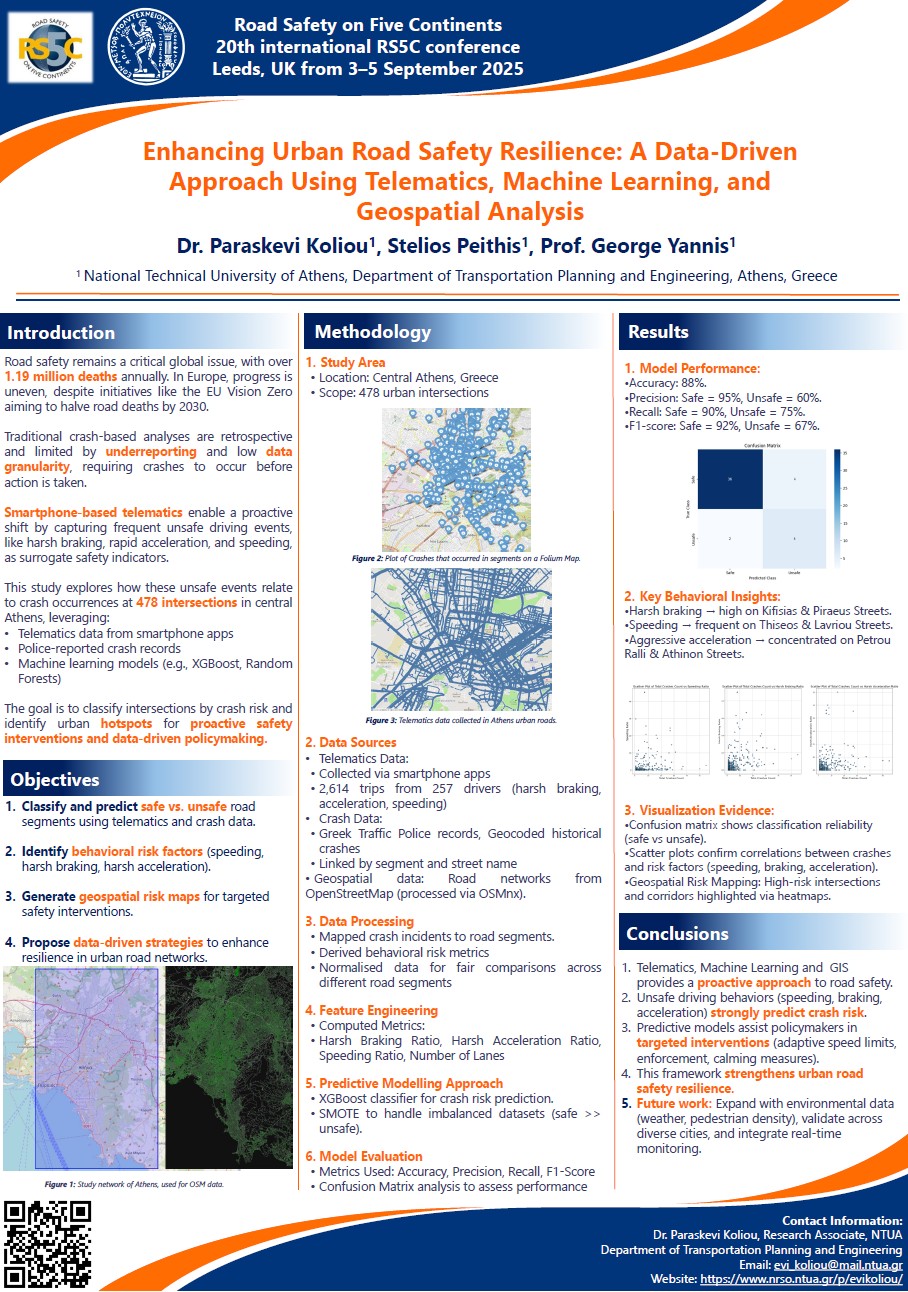
Urban road safety is a fundamental component of transportation resilience, particularly in densely populated metropolitan areas where the complexity of traffic interactions significantly contributes to crash risks. Traditional road safety assessments have primarily relied on post-incident evaluations, which, although valuable, often limit proactive intervention strategies. The increasing availability of telematics data, coupled with advancements in machine learning and geospatial analytics, has paved the way for a transformative shift in how road safety is assessed and managed. These technologies enable the identification of high-risk areas through real-time vehicle monitoring, behavioral insights, and spatial road network data analysis. The research integrates data collection, feature engineering, and predictive modeling. Various data sources were utilized to create a comprehensive understanding of urban road safety risks. Geocoded historical crash data enabled the spatial mapping of crash incidents, while telematics data from 2,614 trips across 257 drivers provided insights into behavioral risk factors such as excessive speeding, harsh braking, and sudden acceleration. Geospatial road network data from OpenStreetMap (OSM) was processed using the OSMnx Python library to analyze road conditions and traffic flow patterns. The predictive model demonstrated high accuracy in identifying unsafe road segments, achieving an overall accuracy of 88%. The model’s precision metrics indicated that safe road classifications were highly accurate at 95%, while unsafe road classifications achieved 60% precision. Recall values showed that 90% of safe road segments and 75% of unsafe road segments were correctly identified. The F1- score, which balances precision and recall, reached 92% for safe segments and 67% for unsafe segments, highlighting the model’s strong capability in distinguishing between varying levels of road safety. This research underscores the transformative potential of integrating telematics, machine learning, and geospatial data to develop adaptive and proactive urban road safety solutions. The findings indicate that driver behavior, particularly speeding and harsh braking, is a critical predictor of crash risks. By leveraging machine learning models, policymakers and urban planners can achieve a more accurate classification of road safety levels, facilitating targeted interventions where they are most needed. This data-driven approach empowers decision-makers to implement strategic safety measures that can significantly reduce crash occurrences, ultimately enhancing urban road resilience.
| ID | pc587 |
| Presentation | |
| Full Text | |
| Tags |