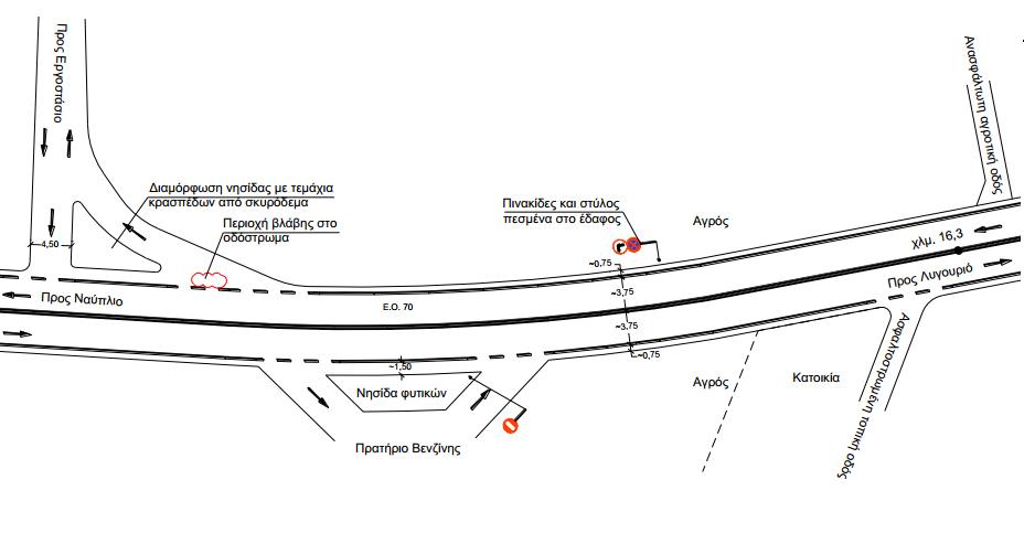
The objective of this work is the presentation of the trial application of the method developed by the Department of Transportation Planning and Engineering (DTPE) of the NTUA, for the identification of hazardous locations of the rural road network and of the necessary countermeasures. The road section which was selected for the trial applicationis the National Road Argos – Nafplio – Ligourio – Palaia Epidavros (N.R. no70).The application of the Poisson method resulted in the identification of the hazardous locations on the specific road. A short description of the existing conditions in each one of these locations was made and the main factors that contribute to the increase of risk were estimated. This estimation was further supported by the available accident data as well as by photos, sketches, findings and conclusions made during the on-site inspection. Information collected from local police officers was also used. Finally, for each hazardous location, a proposal regarding the appropriate countermeasures was formulated. Depending on the identified main risk factors at each hazardous location, the respective countermeasures concern interventions in the geometric characteristics of the road and the road environment, interventions in traffic management and more effective information of road users. Through this trial application of the proposed method it was confirmed that the method is suitable for the identification of hazardous locations and for the selection of the necessary countermeasures on the rural road network of Greece.
| ID | pc137 |
| Presentation | |
| Full Text | |
| Tags | road infrastructure, road safety measures |