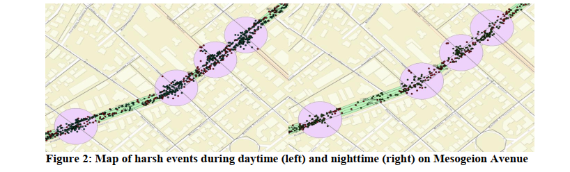
The Internet of Things (IoT) constantly offers new opportunities and features to monitor and analyse driver behaviour in direct assessment and improvement of driver behaviour and safety. Aim: The objective of the current research is to exploit large-scale spatio-temporal data from smartphone sensors to investigate harsh events throughout the selected road axes, specifically at the road segment and junction levels. Methods: Drivers were recorded for one year using an innovative smartphone application and data were imprinted spatially using Geographical Information Systems in order to indicate patterns of the accumulation and ranking of the harsh events regarding time variation. Their measurements are complemented by additional traffic parameter measurements from the Traffic Management Centre of Athens in order to acquire a measure of the surrounding traffic compared to each driver. Subsequently, log-linear regression models were developed in order to associate harsh events numbers with road geometry parameters. Results and conclusions: Results reveal an increase in harsh event counts if average surrounding traffic speed decreases in the respective areas. Furthermore, in segments as the average occupancy increases, there is an increase in harsh accelerations, and as the average speed increases, fewer harsh breakings occur. It appears that traffic characteristics have the most statistically significant impact on the frequency of harsh events. Regarding driver behaviour collected data, the increase of maximum of event speed causes an increase in harsh events. Finally, a strong correlation between harsh events and time variation was found, indicating an overall increase of harsh events during nighttime.
| ID | pc463 |
| Presentation | |
| Full Text | |
| Tags |